On Sunday, July 28, we summited Mount Burstall. Three weeks earliers, on Sunday, July 7, 2024, we ended up at the top of the col below the summit of Mount Burstall. We had not set out to climb Mount Burstall or even ascend the col that day but after we looked up at the summit route, we couldn’t stop thinking about going back and getting to the top.
The story behind how we ended up on the col and saw the summit route is here: Mount Burstall – Col.
Mount Burstall was our first “difficult” summit in the Alan Kane Scrambles book. I was glad we chose this one as our first. There is lots of information on Steven Song and Bob Spirko’s websites (links below) which helped us plan and prepare.
It ended up being a fun adventure. We learned a lot and gained some confidence for more challenging scrambles.


Beta:
- This is an out-and-back route, descending the same way as the ascent.
- Parking: Burstall Pass trailhead – off Spray Lakes / Smith Dorrien Road this parking lot has a trail kiosk, outhouse and garbage bin. It is across from the Chester Lake parking lot.
- Elevation gain: 818 meters
- Distance: about 9.9 km total to the summit and back
- Difficulty: Very steep hiking off-trail over scree and loose rocks, the summit ridge is narrow and very exposed and requires scramble moves. There are lots of holds but the rock is loose (test before you trust).
- Gear: We wore helmets above the col and descending the scree below the col. There was another party on the mountain and it would have been easy to knock rocks onto each other.
Permit Required
A Kananaskis Conservation Pass is required to park at the trailhead.
Helpful Apps
- AllTrails – Mount Burstall
- FATMAP
Books
- Scrambles In the Canadian Rockies by Alan Kane
Trip Report
The first part of this adventure, to the top of the col, was covered in detail in my Trip Report Mount Burstall – Col. Check it out to get the full beta for that section. Below I focus on the top part, above the col.

Here is a reminder of the easiest way to get up the col. When we were there the 2nd time, there was a party of four that tried to ascend a ramp on the right. They ended up coming back down and taking the col instead.
Here is the same area, looking out toward the col, three weeks later on our summit day. There is a lot less snow but the route choice was the same.


From the top of the col, we begin the hike towards the upper section.
We gained elevation quickly on the steep slopes. Looking back down at the col, we see the party of four getting ready to come up.


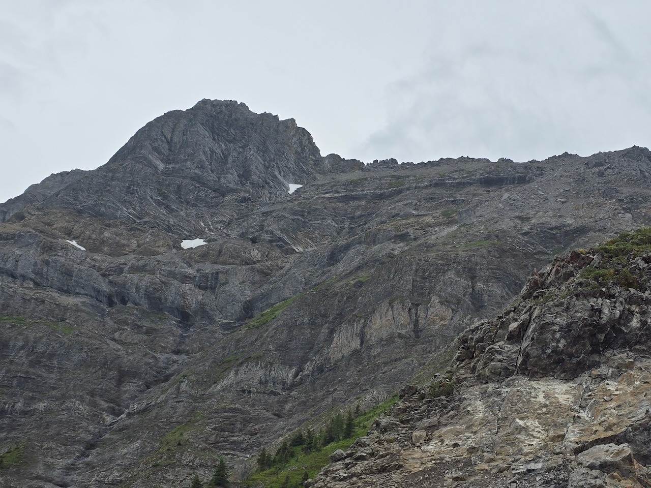
There is a trail across steep green meadows. The route then heads up into scree and talus.
It is best to stay to the right on the upper slopes. It seems a bit less steep over there. A trail winds through the loose rock and avoids the dark cliff band in the photo at the top on the left.


A family of ptarmigan surprises us as we move up through the talus. They are so well camouflaged, we didn’t see them until we were very close.
Near the top of the slope, the route-finding gets a bit tricky. We know we will have to go over to the right side of the ridge at some point.
We went up to the top too soon and decided to come back down and continue on the left side until a good scramble opportunity allowed us to gain the top and drop over.


Here is the route on the right side of the ridge. Dan is walking over loose rock on a ledge about as wide as a sidewalk, maybe a bit narrower, but the drop off on the right is extreme. Careful footsteps are needed.
The “sidewalk” section ends at a chimney. There is a better photo of it below where I am downclimbing.
We need a few scramble moves to get up a featured slab at the top of the chimney. Then there is a narrow section of ridge top, about one body length long, where I crossed “a cheval”. Then a traverse up and around a final tricky section got us to the last bit of trail that led to the summit.


The summit register here is in a Nalgene bottle. We didn’t stop here for too long. The weather was a bit unsettled.
We waited for the other party to make the summit and then we headed down.
Here is a photo of me downclimbing the chimney on our way back down. This photo gives a better sense of the steepness. It is not difficult climbing, there are lots of good holds. But some are loose – test before you trust!


As we descended the scree slope, we looked back up to see one of the other party coming down above us. They waited until we had moved back toward the col to come down the loose scree section. We managed to avoid dropping rocks on each other by keeping enough space between our groups.

A final glance back up at the route from near the col. It was a real adventure. I was pleased with how we had climbed it. We went slowly and carefully, finding the best route and making sure every move through difficult terrain was 100% secure before we committed.
I am looking forward to our next difficult scramble and a chance to hone those skills.
If you would like to be notified when I publish my next trip report, please subscribe.

Reach the peak!
Read about our other summits: