This is a fun scramble with a variety of terrain. The trail goes up through forest, sometimes very steep and other times across plateaus, up and over or around some big rocky formations and towards the top, scree and slab.
The final summit block is a short scramble up a little chimney onto a rocky platform and across a narrow ridge to where the summit register is nestled in some rocks.
This was the longest and highest summit so far in 2023 and the first one that required a few scrambling moves with hands on rock.

Beta:
- This is an out-and-back trail along Highway 40 in Kananaskis
- Park on the side of the road north of the turn-off for Nakiska Ski Resort. The trail starts up a dry creek bed.
- Elevation gain: 881 meters
- Distance out and back: 6.1 km
- Difficulty: a steep hike with no clear trail for the top part which has some loose rocky sections
- Gear: consider bringing micro-spikes if there is snow
Permit Required
A Kananaskis Conservation Pass is required to park at the trailhead.
Helpful Apps
- AllTrails
- FATMAP
Trip Report
On May 6, we summited Wasootch Peak, bringing my total so far this year (2023) to four!
This was the first summit register we signed in a long time, maybe since Willingdon in 2018.

The trail starts up a dry creek bed.
After a few hundred meters, the trail leaves the creek on the left side and goes up through forest.


Looking back across the valley to Mt Kidd on the other side of the highway.
The trail climbs steeply through forest.


Looking back towards Nakiska Ski Resort. Snow and rain are falling in the valley. The storm caught us about an hour later coming down from the summit.
Breaking out of the forest, the trail climbs rocky ground. The summit is in the background.


The trail goes over or around rocky mounds on the way to the summit.
The summit is in the top left of the photo.
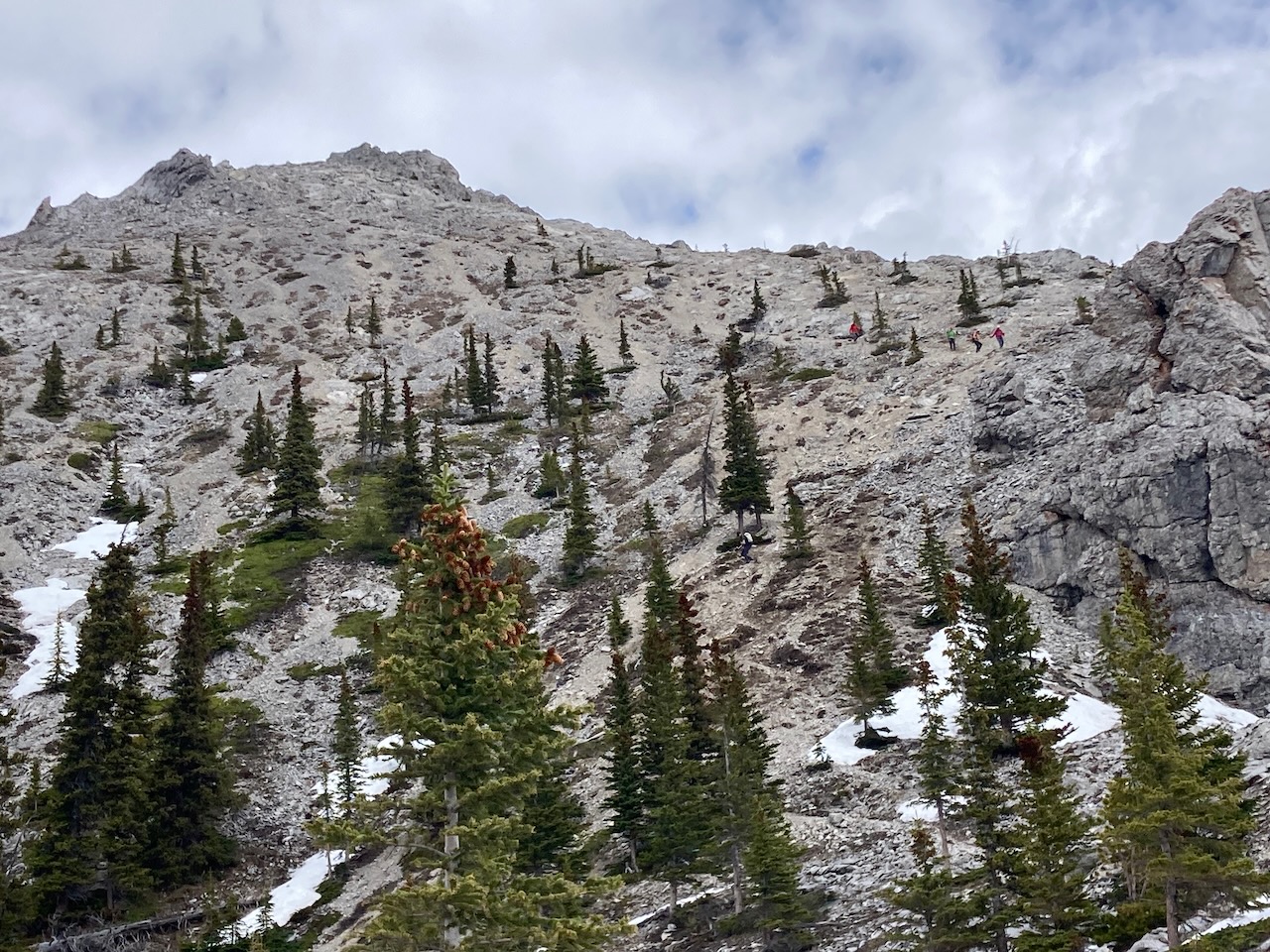
Above the final rocky outcropping, hikers come down the ascent ridge.


The ridge up to the summit does not have a single defined trail. It is a choose-your-own-adventure on scree and slab.
Dan on the scrambling bit at the top. He is coming down the chimney after summiting.


Summit selfie with register in the pink box. I signed our usual “Dan and Angela”.
Some weather came through as we headed down from the summit. The trail goes over/around the rocky mounds below.
The view across the valley shows Fortress Mountain in the distance. Fortress is on the list to be climbed soon.


Reach the peak!
Find more summits:
Leave a Reply