On Wednesday, July 10, 2024, we summited Grizzly Peak in Kananaskis, Alberta.
We had scrambled up Middle Sister the day before and wanted to push ourselves to do back-to-back summit days. Grizzly Peak is shorter and has less elevation gain than a lot of the scrambles in the Kane book so we thought it would be a good choice for Day 2.

(I prefer recording on FATMAP but I thought my phone would not have enough battery power to both navigate on AllTrails and record on FATMAP. So I chose to only use AllTrails. I’m getting a new phone with a better battery so in the future, I’ll be back to sharing my recordings from FATMAP.)
Beta:
- This is an out-and-back route, descending the same way as the ascent.
- Parking: In the ditch along Highway 40 near Ripple Rock Creek.
- Elevation gain: 854 meters
- Distance: 6.4 km to the top and back
- Difficulty: Steep hiking up hard-packed trails and some loose rocks. One scrambly step. No route-finding issues if following the AllTrails map.
- Gear: no special gear was needed at this time of year.
Permit Required
A Kananaskis Conservation Pass is required to park at the trailhead.
Helpful Apps
- AllTrails
- FATMAP
Books
- Scrambles In the Canadian Rockies by Alan Kane
Trip Report
I read somewhere that this route is one of the most popular “hikes” in Kananaskis. That made me curious. I wanted to see for myself what was so appealing.
Having done the climb, I suppose it is the views and the satisfaction of reaching a summit on a not-too-long, not-too-technical route.

Parking is in the ditch on the east side of Highway 40 near Ripple Rock Creek.
After an initial steep climb from the road, the trail levels off.
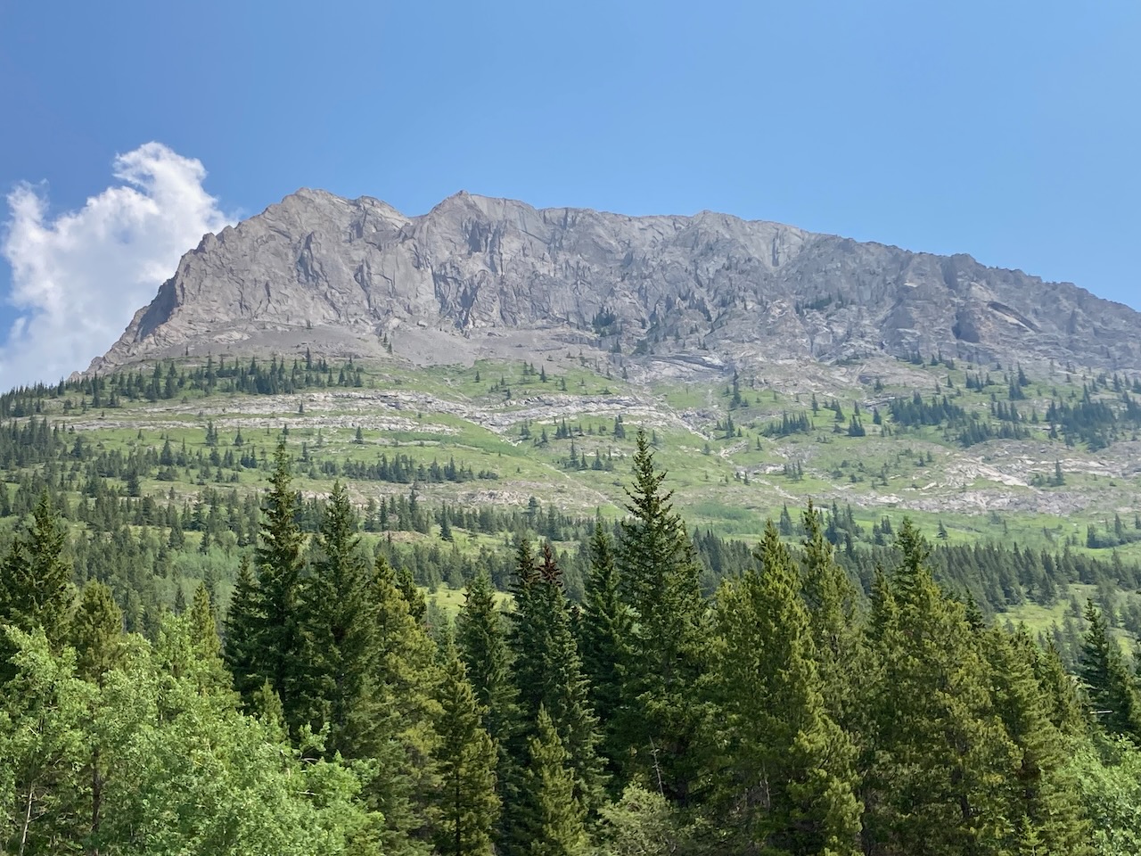
Take note of the high cliff wall in the distance and the treed hill in front of it. Further on when the trail splits into multiple branches, make sure to take a lower trail to traverse the treed hill. The cliff wall comes down low as you go around and you want to be below it.


Soon the steeper section begins and switchbacks gain elevation quickly.
The trail continues up to a small cliff band.


A few easy scramble moves lead to the top of it.
The trail eventually goes around behind the massive summit block to ascend a ramp up the back. It will traverse the green meadows below the rocky cliffs and around the right side (counter-clockwise).


Here we follow the trail through the meadows.
The trail goes up to the bottom of the cliffs and continues around the back.


Continuing around behind the summit block, the trail climbs steeply.
This is the final steep section. The trail cuts across the hard-packed slope and gains the grassy ridge.

From the grassy ridge, it is a straightforward hike up to the summit. The trail goes along the skyline. Zoom in to the photo below to see hikers about halfway up.


Two cairns mark the beginning of the final hike up to the summit.
The summit is up to the left, out of sight.
A lone hiker stands on top.

When we reached the top, we enjoyed views of Mount Evan Thomas, Mount Packenham and Mount Hood to the east. I am super keen to climb Mount Hood and I was interested to see there is not a lot of snow left over there. But we didn’t get a look at the ascent route so there could be more.

To the west, we could see big Mount Joffre presiding over the Kananaskis Lakes. We would love to ascend Joffre but we need to brush up our glacier-travel skills first.

Another day, and another summit with a view. Two in a row didn’t feel too bad. Maybe next time, we’ll try for three.
If you would like to be notified when I publish my next trip report, please subscribe.

Reach the peak!
Read about our other summits:
Leave a Reply