On Tuesday, July 16, 2024, we summited Mount Kidd in Kananaskis, Alberta.
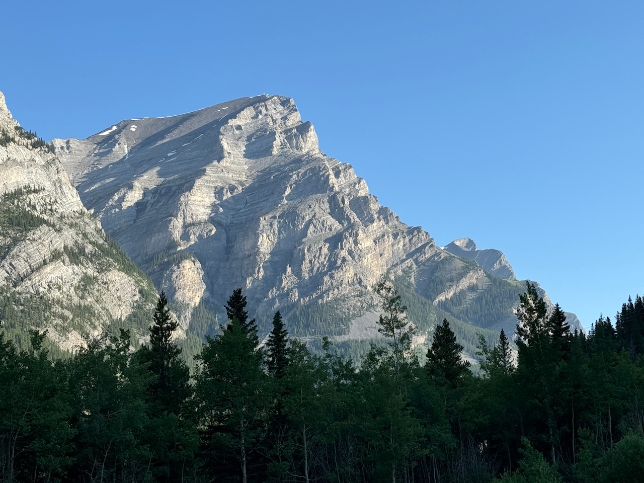
This iconic peak is visible from Highway 40. It comes into view as we drive south on Highway 40 and it always looks magnificent.
We see it often in the winter when we go skiing at the Highwood Pass or ice climbing at King Creek. We see it in the summer as we head down that road to hike, backpack, rock climb or scramble other peaks in the area.
I used to think that Mount Kidd could only be climbed with ropes and climbing gear but about a few years ago, I realized it could be scrambled. After that, whenever we drove north past the mountain, my eyes would search the south face, where I knew the scramble route went, looking for the best line. Really, looking for any line because the entire face looked steep and blank from the highway. I finally got to see close up exactly what the face looked like as well as the entire route up from the highway.

Beta:
- This route is out and back
- Parking: At Galatea Creek Trail Head on Highway 40 Kananaskis Trail
- Elevation gain: 1,480 meters
- Distance: 11.5 km total
- Difficulty: Steep snow above the creek. Steep off-trail scree, slab and loose rocks on the upper section. Some route-finding on the top section finding the best way to gain the summit ridge.
- Gear: an ice axe might be helpful for the steep snow sections. We used lightweight aluminum crampons to ascend the snow as it was a bit firm and the crampons made it easier.
Permit Required
A Kananaskis Conservation Pass is required to park at the trailhead.
Helpful Apps
- AllTrails: Terrace Trail to Mount Kidd
- FATMAP
Websites
Books
- Scrambles In the Canadian Rockies by Alan Kane
Trip Report
The scramble route for Mount Kidd ascends the main drainage on the south side of the mountain.

The entire route is visible from below with the drainage visible from the highway and the upper part of the route visible from the parking lot.
The Approach Hike
The route starts on a wide trail and heads down a hill to the river. It crosses a suspension bridge and carries on through the forest.
It then crosses this wooden bridge and comes to a t-intersection.


Here, a sign indicates the Terrace Trail is to the right.
The Terrace Trail is wide and easy to follow. It is mostly flat with a few rolling sections, paralleling the river.


After about half an hour, the trail crosses the creek that drains the south side of Mount Kidd.
Cross the creek and turn left to follow the smaller trail up the right side of the creek.
This smaller trail leads up toward the drainage.


A little further on, the drainage comes into view. The route stays on the right side.
Start of Scramble Section
Next to the lower waterfall, there are chains that help you around this steep section. We missed the chains on the way up because we were on a different trail that went across the slabs higher up. We missed the chains again on the way out because we were on a lower trail and crossed below the chains.

I found I didn’t need the chains but if you want to aim for them, the arrow in the photo below shows where to look.

Above the chains section, there are faint trails that traverse the hillside above the creek.
We found on the way out that staying lower, closer to the creek, was easier.


Looking back down the drainage from the top of the creek.
From the top of the creek, a trail continues towards the bottom of the upper basin and the snow field.


The snow field was a bit firm and it seemed like kicking steps into it would be hard work.
We had brought our lightweight aluminum crampons and decided that since we’d brought them, we might as well use them.


The crampons made it a lot easier to move up the snow.
Above the snow field, we went up slabs. The long section between the snow field and the summit ridge is either loose rock and scree or slab littered with rubble.
We tried to pick our way from one patch of solid rock to the next.


The tall rock pinnacles above block the way to the summit ridge. We decided to work our way to the left so we would be able to go around them and then angle right to the summit ridge.
This is typical terrain on the upper slopes. It was discouraging. We seemed to always be forcing our way up but not getting much closer to the top.
At some points, I thought we might be way off route. Looking up, I couldn’t see any way through the cliffs and pinnacles above to the summit ridge.
I even felt at times like we might be on the wrong mountain. This was not the terrain I had expected when I looked at the smooth south face from below.


As we worked our way to the left, we hoped to find “the trail” thinking a well-worn track through the scree would make the ascending easier.
When we couldn’t find “the trail”, we looked for any trail at all and sometimes found one that took us a short way but it always petered out in the scree and loose rock.
No real trails and not a single cairn to be found. We persevered, making our way higher bit by bit and eventually saw a way to the summit ridge.
Summit Ridge
Finally topping out on the summit ridge. Now an easy hike will get us to the top.


Near the top, we find some interesting fossils. This rock is full of closely packed, cylindrical, ancient plants or animals.
This is the same rock turned over to show the inside of the cylindrical fossils.


There are structures on the summit that include a small building…
… and a platform.

Views from the Top

From here we look down at our truck in the parking lot below.
The pointy mountain in the middle of the photo is called “Spoon Needle”.
Looking down another side, we look down on Ribbon Lake and Ribbon Falls below.

It was great to stand on top of this iconic mountain. I told Dan that we had to reach the summit on this attempt because I was never going back up there. The upper slope was tough for me and I was relieved to be done with it.
The descent was much easier, sliding down the scree that had thwarted us on the way up. After some careful downclimbing on the slabs and plunge-stepping down the snow, we were back on the trail and headed for the truck. Another successful summit attempt.
If you would like to be notified when I publish my next trip report, please subscribe.

Reach the peak!
Read about our other summits:
Leave a Reply