This is a popular scramble in Kananaskis and I’ve wanted to do it for many years. Note that the trail to Chester Lake is regularly closed in June to allow the trail time to dry and prevent damage to fragile areas. We decided to wait until the snow had melted off, later in the summer. We did this scramble on August 22, 2026.
The hike to the lake is a nice day hike with a steady uphill, steep in parts, but mostly gradual. The scrambling section consists of a steep walk up a gully and then a steep slope of scree and slab. There is some flexibility to choose your line up the final section, ascending scree or slab as you like. There isn’t a continuous, well-defined trail in the upper section.
We studied the descriptions in the Kane Scrambles book as well as Bob Spirko’s website (link below) and AllTrails. Using the trail descriptions from those sources, the route was pretty straightforward. Our route is the blue line on the map below, recorded in the GaiaGPS app.

Beta:
- This is an out-and-back route, descending the summit the same way as the ascent.
- Parking: Chester Lake trailhead
- Elevation gain: 1,175 meters
- Distance: about 12 km total, out and back
- Difficulty: Steep hiking up hard dirt and scree. Scrambling up short slabby sections with good foot and hand holds.
- Gear: helmets are a good idea, especially if there are other people above you. There is a lot of loose rock on the upper slopes.
Permit Required
A Kananaskis Conservation Pass is required to park at the trailhead.
Helpful Apps
- AllTrails – Mount Chester
- GaiaGPS
Books
- Scrambles In the Canadian Rockies by Alan Kane
Trip Report
There is a large parking lot for Chester Lake. There are outhouses and garbage bins there. The trail starts at a kiosk.

We started up the well used trail, passing through a gate.
This is a popular trail. We saw many people heading to the lake with fishing rods.


After about 10 minutes of walking, we came to an intersection.
We followed signs to Chester Lake.
The trail was very well-defined.
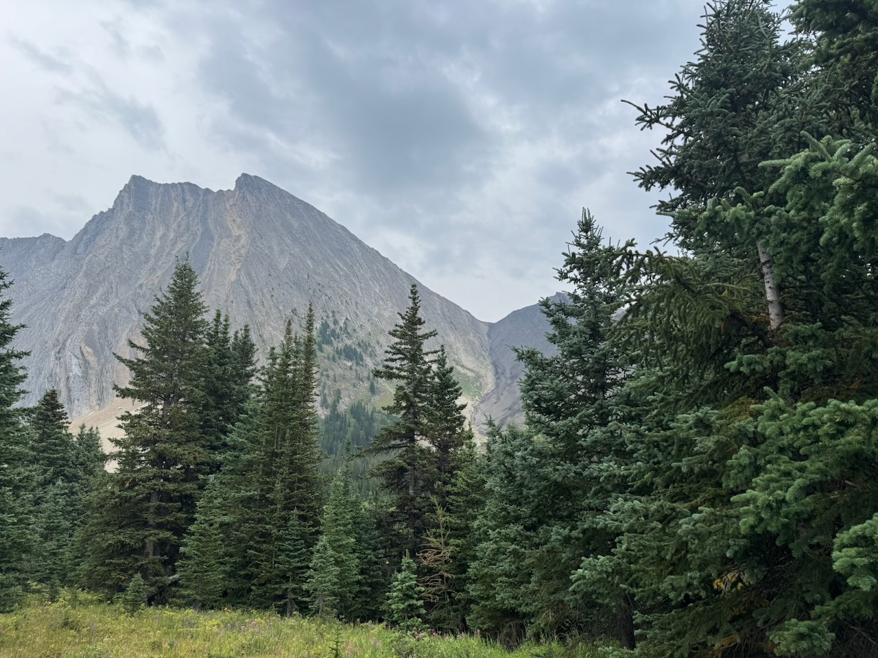
Mount Chester is in the distance.


Good signs and a wide, easy trail continued toward the lake. The trail went uphill gradually most of the way.
When we got closer to the meadows, a sign indicated that the area was fragile and everyone should stay on the trail.
This is why we hiked all the way to the lake and then turned toward the summit route. We avoided cutting across the meadows even though that would have been a more direct route.


Getting closer to Mount Chester. Little Chester is the smaller, brown summit on the right. The ascent route goes up a gully between Mount Chester and Little Chester. Then from the col, it wraps around the back before ascending slab and scree.

The ascent gully became visible as we hiked toward the lake.
In this photo, it looks steeper than it really is.
Here is a close up of the ascent gully. Again, it is not as steep as it appears in the photo.
The ascent route goes up the middle of the gully and not on the grassy slopes on the side which are actually steeper and more difficult.


After a little over an hour, we arrived at the lake. Turning right, we crossed the outflow stream.
A good trail follows the lake shore toward the ascent gully at the base of Mount Chester.
The trail moved away from the lake shore and turned towards the gully.
At first, the trail went through rocky meadows.


We continued through the meadows. Little Chester was in front of us.
The trail entered the forest at the end of the meadow and continued to the gully.
Coming out of the other side of the forest, we were near the base of the gully.

Up the Gully

Here Dan is starting up the gully.
There is a pretty good trail most of the way. The key is to stay in the gully and not wander up on the sides. The sides get very steep further up.
This photo shows the typical steepness and type of ground cover on the hike up the gully.
In places it was a bit more rocky and loose.


Here I am near the top of the gully. Dan took this photo from the col between Mount Chester and Little Chester.

We took a break on the col and looked up at the next section.
A trail wound around the back of the mountain from the col.
Above the Col

I am standing on the trail here looking across the valley. This type of rocky, loose talus is typical of the remainder of the ascent route. We followed the trail across the slope.
Eventually, the trail petered out and we turned left to head more directly up towards the summit.


I put my trekking poles away and used my hands to help move up. Behind me, the near ridge is Little Chester. In the distance is Burstall Pass.

From here, the route finding involved choosing between grinding up scree and finding more solid slab to scramble up.
At times, the best route was hiking up the base of the slab where the ground was a bit more solid.


Some sections were loose rubble.
Other places had more solid slab.


This terrain is typical closer to the top. Here I think we were about 20 minutes to the summit.

Here Dan is standing at the top of a large slab. He didn’t go straight up the slab. There was an easier way off to the right.
The hands on climbing was made easier by the featured nature of the rock. No shortage of holds!


Dan picked a path toward the summit.
We found a trail for the last 10 minutes or so before the top.


On the summit, the usual pink box was waiting.
Inside, only a few little notepads and pencils. Some other summits had more interesting items such as a small bottle of Fireball whiskey. Not the case on this one.
Mandatory summit selfie!

Descent
The descent was straight forward. We retraced our steps, choosing more loose scree to go down from the summit. In the gully, we looked for looser, dustier ground that would accommodate a heel plunge and make descending easier.
I was happy to check this one off the list. It wasn’t my favourite scramble. Lots of slogging up loose ground. I’m glad it’s done. Not in a hurry to do it again.
Rating / Grade
I found this scramble a bit easier than Mount Hood and Bald Eagle. It was definitely harder than Ha Ling and the other F2’s on this website.
If you want to be notified when I publish new Trip Reports, subscribe to this website here:
If you’ve climbed Mount Chester, please share your thoughts on the experience in the Comments box below. If you are planning to climb it and you would like more information, contact me using the Contact page.

Reach the peak!
Read about our other summits:
Leave a Reply