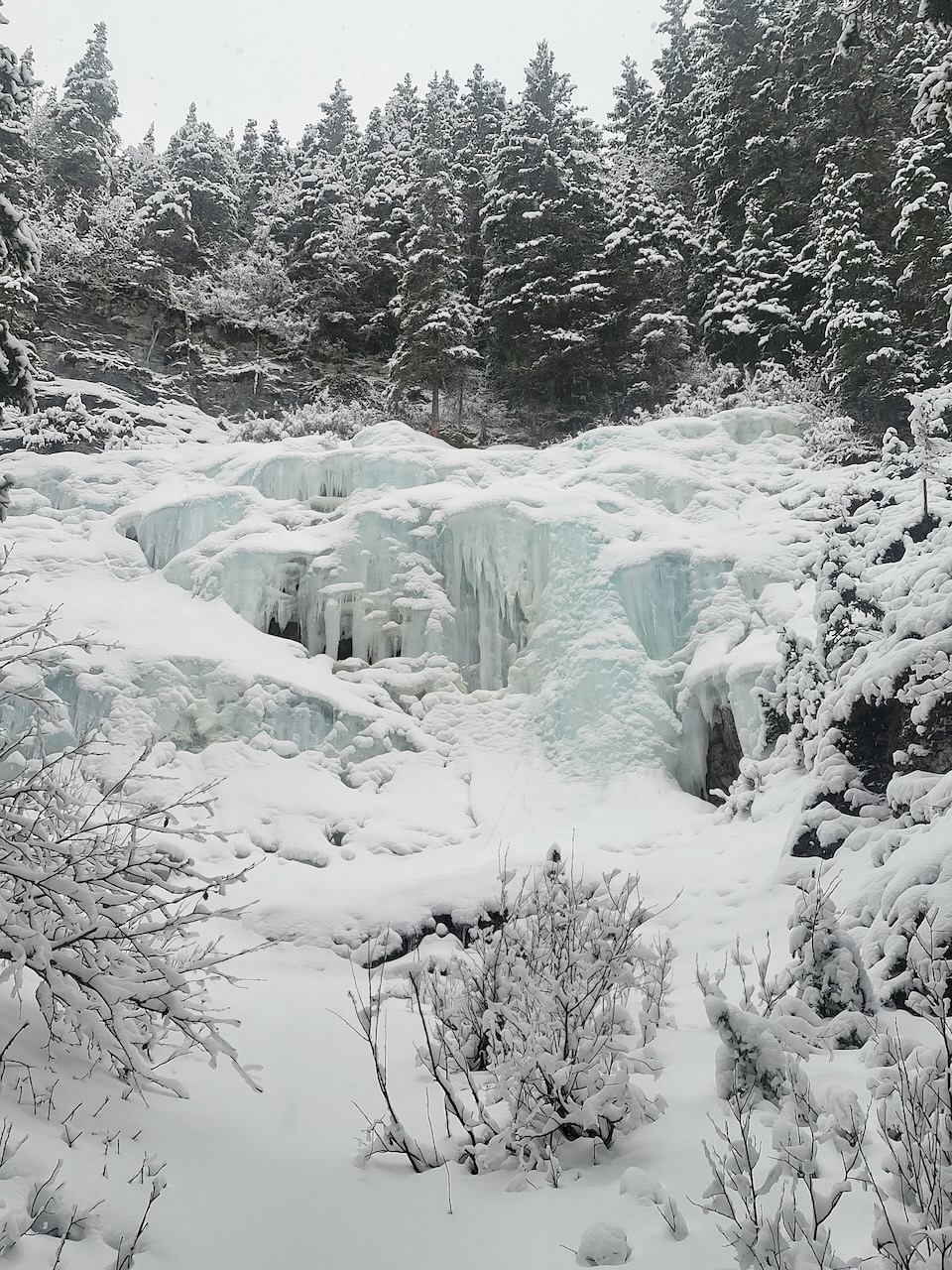

We have climbed here a few times, most recently on February 4, 2024. The above photo was taken on that day.
The beta:
- WI2 and WI3 lines
- single pitch
- you must lead to set a top rope, there is no walk up
- the anchor is a tree at the top of the ice in the center
- 2.5 km hike in, part on trail and part bushwhacking
- 175 meter elevation gain on the approach
Here’s how it looked on December 22, 2022. The ice was much fatter that year.

This is a fun area to come play around on some easy but interesting ice with some steep sections and bulges. We have been there three times and always had the ice to ourselves. Perhaps the approach discourages others from climbing here.
The Approach
The approach for this climbing area can be long and difficult, especially in deep snow. We found it using the app Ice and Mixed: Western Canada, which has a Navigate button that will take you to this climb. Read more about the app here https://willgadd.com/ice-and-mixed-app/
The map shows our route to the ice, recorded in the FATMAP app. It starts at the Galatea parking lot and follows the Galatea Lakes trail first across the Kananaskis river on a suspension bridge, then across a smaller bridge and left at a trail intersection. The trail climbs uphill on a couple of switchbacks before dropping down to a creek.


Cross the creek on another bridge and continue for a few minutes until you come to another bridge. Here you leave the trail and either head up the frozen creek or climb steeply up the bank on the left side.
Work your way up the left side of the creek, sometimes on game trails, sometimes bushwacking until you find the open meadow in the photo. Traverse across the meadow and shortly after re-entering the trees, cross the creek to the right side. Look for game trails to continue up the creek.


Eventually, you start to see cliffs on the left side of the creek. You can then start looking for the ice uphill on the right side of the creek. The ice is not visible from the creek, you must hike uphill to find it. We searched around quite a bit the first time we went out there.

Leave a Reply