The hike to the summit of Ha Ling Peak is not really a scramble. There is no need for hands, no scrambling on this route. The trail is easy to follow and there is no challenge with route finding. There is a hiking trail most of the way and some of the steeper sections have stairs and hand rails.
There is a great view of the town of Canmore from the top. It’s a lovely place to watch the sunrise if you’re willing to start before dawn with your headlamp.
The hike goes up hill most of the way with no dips or flat spots. Some spots are very steep but most of the trail is no steeper than typical stairs.
I have climbed Ha Ling before but this was the first time I’ve been on it since the trail was re-done. This entire area was closed to the public for a full summer a few years ago while construction crews worked on the trail. The result is a lovely trail with broad switchbacks that take you up the side of the mountain.

Beta:
- This is an out-and-back trail
- Park at Goat Creek parking area on the Smith-Dorrien/Spray Lakes Road south of Canmore
- Elevation gain: 795 meters
- Distance out and back: 7.8 km
- Difficulty: a hike, moderately strenuous
- Gear: consider bringing micro-spikes if there is snow
Permit Required
A Kananaskis Conservation Pass is required to park at the trailhead.
Current Trail Conditions
Helpful Apps
- AllTrails
- FATMAP
Trip Report
On April 20, I summited Ha Ling Peak, my second peak of 2023. I almost didn’t go. I sat drinking coffee at home in Calgary, watching the snow fly sideways past my window and thought seriously about calling it off.
It would have been easy. Nobody was going with me. I could have just brewed a second cup of coffee, turned on the TV and stayed inside where it was warm.
But I had a goal. I wanted to climb 20 peaks in 2023. I had only done one at that point and I decided I better go get number 2 on a day when I had time and energy.
The Approach

As I drove toward the mountain, the clouds opened up and showed the summit of Ha Ling. This was the first blue sky I saw that day. I started feeling good about my decision to try the climb.
The front side of the mountain looks intimidating but the hiking trail is around the back. There are multi-pitch rock climbing routes that go up the front.
The Welcoming Committee! A few sheep share the road on the final leg of the drive to the trailhead.

The Hike

A sign near the start of the trail gives hikers a great overview. The yellow line is the trail which cleverly avoids the red avalanche prone areas. The trail ends above tree line at the saddle between Ha Ling and Miner’s Peak.
The rest of the way to the summit there is no trail and you find your own path to the top. On this day, this section was covered with deep snow.
The first part of the trail is through forest. Very peaceful with all the fresh snow. The mist in the trees made it feel almost other-worldly. I half expected to find a portal to Narnia.


Higher up, the views start to open up. This is looking southwest towards Goatview Peak.
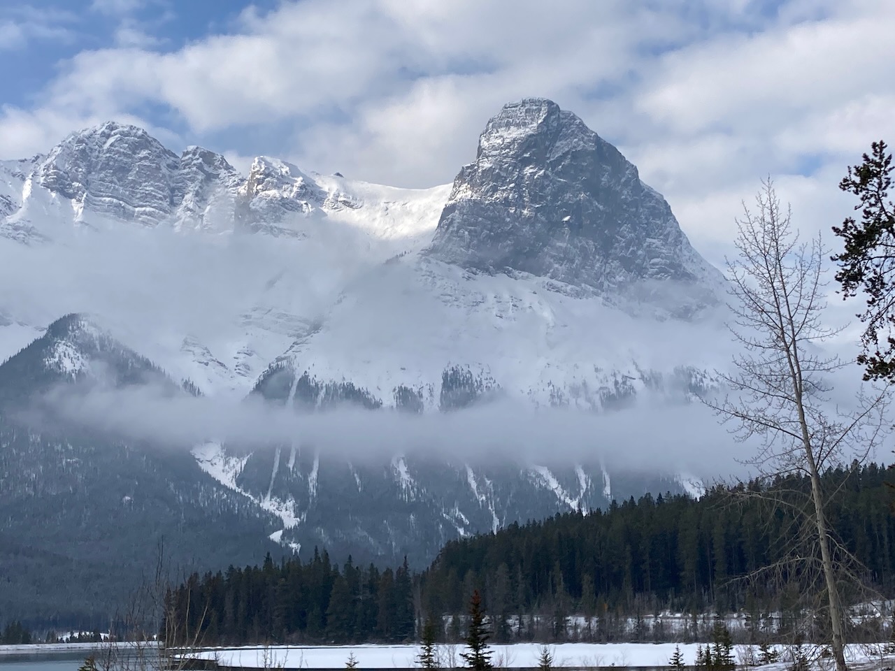
Looking across the valley at East End of Rundle (EEOR). There are many multi-pitch climbs up the rock face.


Up at the saddle and the end of the trail. This is looking up the ridge toward Miner’s Peak, the wind has sculpted the snow.
The final push, from the saddle to the summit was deep untouched snow when I arrived but luckily for me, a hiker ahead of me decided to push on. She broke a trail through the knee-deep snow right up to the summit. All I had to do was follow her footsteps.
This final push was a bit slippery and slow but well worth the effort to stand on top!

Ha Ling Peak was a good second summit. It was easy from a technique perspective but challenging enough in the distance and elevation gain to improve my fitness. My goal at this point was to build fitness through spring and try some more technically challenging peaks in the summer.
My next summit, Little Lougheed, would continue the fitness push.

Reach the peak!
Find more summits:
Leave a Reply