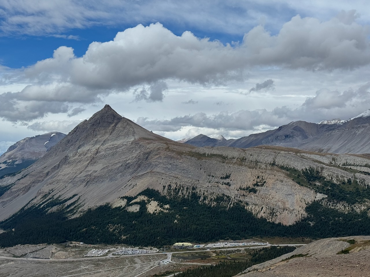
On September 10, 2026, Dan and I climbed Mount Wilcox. It is directly behind the Icefields Information Centre and visible from the Icefields Parkway. There are spectacular views from the top and along the way which include alpine meadows, numerous glaciers, and towering, snowy peaks.
Dan and I were camping at Wilcox Creek Campground. We had taken a course on glacier skills with Yamnuska Mountain Adventures and climbed A2 with mountain guide Nick. and Then we climbed Mount Athabasca on our own.
We were so stoked from climbing Athabasca, we wanted to do another summit. But maybe something a little less complex and committing. We decided to check out a scramble from the Alan Kane book. Mount Wilcox looked fun and interesting from the summit of A2.
Although this scramble includes some hands on movement up and across rock with serious exposure, it is possible to hike quite a ways up before the hands-on part begins. Much of this first section has a decent trail. The pay off for this steep hiking is huge in terms of the views you get.
As with many scramble routes, the difficulty of the climbing depends on which way you go. We had some moves on the way up that I felt were well beyond the Class 3 or moderate rating but on the way down, we were able to avoid some of these sketchy sections by staying high on the ridge. Details and photos are below.

Beta:
- This is an out-and-back route, descending the summit the same way as the ascent.
- Parking: Wilcox Pass trailhead
- Elevation gain: 851 meters
- Distance: 12.9 km total, out and back
- Difficulty: Steep hiking up trail and scree. Hands on scrambling up steeper sections with some exposure.
- Gear: helmets
Permit Required
A National Parks Pass is required to park at the trailhead.
Helpful Apps
- AllTrails – Mount Wilcox
- GaiaGPS
Books
- Scrambles In the Canadian Rockies by Alan Kane
Trip Report
The Wilcox Pass trailhead parking area has an outhouse on one end and a trail kiosk where the trail begins.

We started up the well used trail. This is a very popular hike and the parking area can get very crowded on sunny weekends in the summer.
The trail entered the forest and started uphill, gradually at first.


A very rooty section of the trail through the forest.
After about half an hour, we were treated to views across the Icefields Parkway to the glaciated peaks at the edge of the icefield.
The Information Centre is far below.


Another 10 minutes brought us to views up to the pass.
A person is silouetted at the top of the slope in the photo.
As we ascended the pass, we started to see the top of Mount Wilcox in the distance.
A person is visible at the top of the slope. Bighorn sheep (rams with their curly horns) were grazing and lounging on the slopes left of the trees.


The views from the pass are insane! This is looking across the parkway at Mount Athabasca and Mount Andromeda. This hike has the best views for the amount of effort invested of all the hikes I’ve done!

Here we had a better view of the rams in their spectacular home.
Mount Wilcox is in the distance with a few clouds playing on the summit.
There was some precipitation in the forecast for the afternoon. I hoped we would be off the summit by the time it rolled in.


The summit route goes from left to right, climbing the slopes on the left and traversing upwards toward the summit.

A Parks sign points the way to Wilcox Ridge. We followed this trail partway to the ridge before turning right on an unmarked trail that led toward the mountain.
Clouds were still clinging to the summit area but we were undeterred.
The trail to the ridge was marked by piles of rock wrapped in chicken wire and adorned with a bright yellow plastic diamond.
At first, the trail went through rocky meadows.


We were tracking our position against the trail on AllTrails, which I downloaded before we headed out, and the trail on GaiaGPS.
The turn off toward the mountain and the scramble route is a very faint trail and I was glad we had the mapping apps to assist with finding it.
We dropped down a bit to cross meadows between the ridge and the scramble route.

Up the Mountain

On the lower slopes of the mountain, the trail was obvious.
It switchbacked sometimes and other times climbed steeply up toward the ridge.
We continued on excellent trail across the lower slopes.
We were continuously rewarded with amazing views.


I enjoyed the hiking on this section of the mountain. I thought the trail was straightforward and easy to follow, the alpine plants along the trail were pretty and of course, the views…

We continued up the trail, traversing the lower slopes on our way to the more scrambly summit slopes.
The trail traversed through more colourful alpine plants.
The more rocky, scrambly summit ridge is visible in the distance.


Further up, we left the plants behind. The trail made a solid path through loose rocks. The summit ridge was still far ahead.
Getting closer to the summit ridge, we continued on a surprisingly good trail.


From the top of the first ridge, views opened up to the north.
We hiked near the top of the ridge on the trail toward the summit ridge.


When we hit the broken ground of the summit ridge, it seemed like the trail faded off and split into different, indistinct strands. Here we had to consider the best route. Typically, we chose between going up to the ridge, or traversing below the top. We felt we should have tried to hike along the top more and that would have been easier.
This photo gives a good sense of the steepness of the terrain in this section. We chose where to scramble over ribs of rock that came down from the ridge top and looked for solid footing on the loose scree between the ribs.


At times, our route-finding decisions were confirmed when we found cairns with flagging tape.
Here a trail seemed to lead up onto the ridge. We enjoyed an easier track for a few minutes.


Another cairn with flagging tape showed us the way up and over the rib.
There were quite a few helpful cairns in this section.
A few times, I thought we were on the final climb to the summit but then more mountain appeared in the distance.


At last the summit was in view and there was no more mountain behind it.
At that point, we hiked over the ridge and came up the other side. There was an obvious trail there to follow.
Dan stood beside the summit cairn. Clouds had come in and obscured all the scenery.


Obligatory summit selfie. We were pretty excited to be on top.
Snow was swirling around the summit and we hurried to reverse our track before the snow could start to build up and make the descent slippery.
Descent
We generally went back down the way we had come up. But on the descent, we tried to stay to the top of the ridge a bit more.
The clouds surrounded the summit.
The trail was mostly good along the top of the ridge but a couple of times, we decided to turn back and drop down.


As we dropped down through Wilcox Pass, we noticed that the rams had moved closer to the trail.
Wilcox Peak was a fun scramble with an interesting route. The views were amazing. This is one of only a few Kane scrambles I would do again.
Rating / Grade
Kane rates this scramble “moderate”. I found it had more climbing moves and more exposure than Mount Chester in Kananaskis, which is also rated moderate. I thought it was similar in difficulty to Mount Hood and a little easier than the crux on Bald Eagle Peak.
We were planning to take on Nigel Peak next but a storm dumped a bunch of snow on it before we had our chance. We decided to drive down to the David Thompson and check out the rock climbing there rather than wait for Nigel to thaw. Nigel will have to wait until next summer.
If you want to be notified when I publish new Trip Reports, subscribe to this website here:
If you’ve climbed Wilcox Peak, please share your thoughts on the experience in the Comments box below. If you are planning to climb it and you would like more information, contact me using the Contact page.

Reach the peak!
Read about our other summits:
Leave a Reply