I decided to climb Mount Yamnuska today (June 24, 2023) because Dan couldn’t join me and it’s not a mountain he wants to climb again. I didn’t want him to feel he was missing out. He still did but not as bad as if I’d climbed a mountain he was eager to do too.
I also chose Yam because I’ve been up it before, years ago, and it was a fun scramble. The trails there were rebuilt a couple years ago and I was curious to see the changes.
I climbed it on a warm sunny Saturday and boy was it crowded! The scrambling was fun and the chains were as spicy as I remember. Great day.
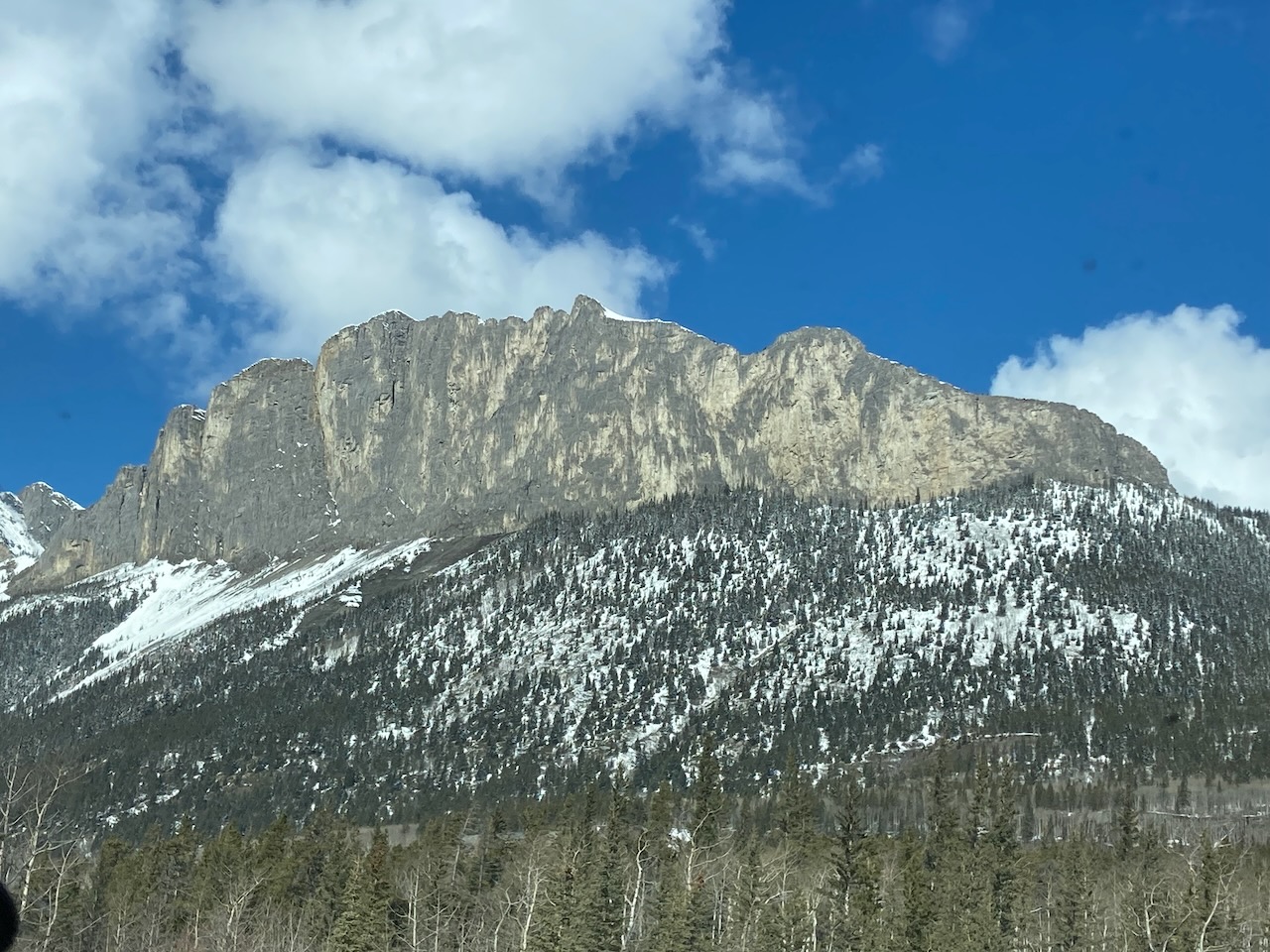
Note that the photo above, at the top of the page, is one I took in April when Dan and I hiked up the front to look at climbing routes. Today there was no snow.

Beta:
- This is a loop trail. It works best to go counter-clockwise.
- Park at the Yamnuska parking lot on Highway 1A east of Exshaw.
- Elevation gain: 903 meters
- Distance: 10.6 km for the complete loop
- Difficulty: A scramble. Very steep hiking up dirt, rocks and slabs with scrambling sections. Be prepared to use your hands and pull some climbing moves to get up short sections of steep rock.
- Gear: no climbing gear is needed but ensure you have sturdy shoes or boots that will grip on steep rock. Approach shoes are perfect. Some people wear climbing helmets.
Permit Required
A Kananaskis Conservation Pass is required to park at the trailhead.
Helpful Apps
- AllTrails
- FATMAP
Books
- SCRAMBLES In the Canadian Rockies by Alan Kane
Trip Report

A beautiful day for a hike! It starts in a forest, flat for a short time, over a little bridge. Then the uphill starts.
The trail builders have created stairs from flat stones at strategic locations. There are also many signs along the trail now to ensure you get to where you want to go. Here the signs tell hikers and scramblers to go right. This loop is definitely done counter clock wise. Never clock wise.


Once on the hiker and scrambler trail, you traverse the slope heading uphill on an excellent trail.
Looking at the rocky top half of the mountain. The trail traverses the right side of the mountain up through the trees onto the shoulder. Then it goes along the top of the shoulder to the base of the rock on the right or east side. This area is called Raven’s End.


Here on top of the shoulder, the trail heads up toward the rocky top half of the mountain. You can start to see the back of the rocky section where the scramble trail goes up.
Stairs take you up towards Raven’s End. Once there, you see a sign telling you that continuing on is a serious scramble and should not be undertaken unless you have scrambling experience.

The Scramble Begins

The first scrambling feature is a fun chimney to climb up. It has large boulders and great handholds. A great warm-up for the scramble. I took this photo from the top of the chimney, looking back down the way I had come up.
The blue squares show you where to go.
This is a good representation of how the route is for much of the scramble. You climb the rocky steps on the left and continue on the trail in the upper left side of the photo. There are a number of trails lining the hillside ahead. The best route is marked with blue squares bolted to the rock.


This fun part of the route climbs these rock steps. If you zoom in, you can see another blue square near the top of the slope. There is some exposure with a bit of a drop off behind. There is loose rock on ledges but it is not hard to find solid hand holds.
Here there is a trail to follow up the left side of the photo. Up ahead you can see someone running the trail.


Another fun rock step to climb.
Looking back at two hikers enjoying the view.

The Famous Chain Section:

This photo shows a hiker moving across a narrow ledge using the chains for safety. The chains are bolted to the rock and take you across the ledge and then down onto the gravel section. A blue square near the bottom right corner of the photo shows where you need to go.
The final trail to the summit winds across and up a steep scree slope.


Summit selfie. That makes eleven!
The descent trail goes steeply down hard scree and gravel. Very tough to stay up right on such sliding, rolling terrain.


The trail down to the West Col. The descent trail goes down into the trees to the left, making a long traverse through the trees to the parking lot.
Stairs on the descent trail make it easier.


A waterfall along the descent trail is just a trickle right now. In winter, it forms a beautiful sheet of waterfall ice which we will surely come back to climb in winter.
Back down through the forest near the bottom of the mountain.


A resident of the forest shares the trail with me. Before long, I am back at the parking lot.
I enjoyed this scramble a lot. I thought the trail improvements completed a few summers ago helped make the trail easier to follow and more straightforward. Previously, there were many trails winding around the mountain that would get muddy and eroded the hillsides. Now a well built trail takes all users up the best and safest line. New signage ensures that people venturing up the chimney at Raven’s End are prepared for the challenges above.


Reach the peak!
Read about our other summits:
Leave a Reply